Your Cart is Empty

Explore Deep Creek - Savage River with Purple Lizard Maps
March 14, 2025 3 min read
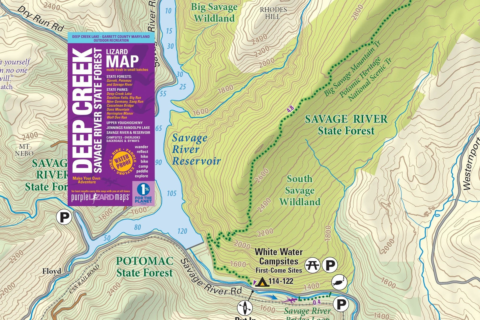
The Purple Lizard Deep Creek Lake - Savage River State Forest Outdoor Recreation Map
Outdoor enthusiasts and adventure seekers, we're thrilled to announce the latest addition to the Purple Lizard Maps collection: the Deep Creek Lake - Savage River State Forest Map. As an award-winning outdoor recreation map company, Purple Lizard Maps continues to set the standard in cartography with this exciting new release.
Get ready to explore one of Maryland's most stunning outdoor playgrounds with a map designed to inspire your next adventure!

Connecting to Landscapes and Communities
The Deep Creek Lake - Savage River State Forest Map has been meticulously developed over several years, covering the scenic landscapes of Garrett County and Deep Creek Lake, along with Garrett, Potomac, and Savage River State Forests. The map even includes a small but beautiful section of West Virginia!

To bring this new project to press, Purple Lizard Maps partnered withMountain Watershed Associationwhich works to protect, preserve and restore the Youghiogheny River watershed and its broader communities through conservation, recreation, education, and advocacy.
This comprehensive guide features a diverse network of trails, campsites, and scenic spots, including mountain bike trails, hiking paths, ski routes, and OHV trails. It also highlights some of the best whitewater boating access on the East Coast.
Michael Hermann, founder of Purple Lizard Maps, shared his excitement about this new release:
"We are thrilled to introduce our first Maryland title with the support of the Mountain Watershed Association. This map is more than just a navigational tool for outdoor enthusiasts; it’s a celebration of Maryland’s natural beauty and a rich invitation to connect more deeply to this beautiful area. We’ve carefully crafted it to help people dive in and discover the wealth of recreational options and hidden gems that make this area special."

Josh Spiker, Director of Garrett Trails, an organization that has significantly expanded trail resources in the region, helping to make it a premier destination for outdoor enthusiasts, added,
“Purple Lizard has created an incredible resource for the modern explorers of western Maryland. Using this map, the adventurous can be confident in finding an outdoor recreation opportunity that suits them.”

Eric Harder, Youghiogheny Riverkeeper with the Mountain Watershed Association, which supported the project, also praised the map, saying,
"We appreciate and applaud the effort by Purple Lizard to responsibly promote recreation in this unique area.”

A Gateway to Adventure
The Deep Creek Lake - Savage River State Forest Lizard Map opens up a world of adventure, highlighting various recreational opportunities, including:
- Deep Creek Lake: Maryland’s largest freshwater lake, perfect for boating, fishing, and water sports.
- Savage River State Forest: Over 54,000 acres of terrain, offering exceptional hiking, mountain biking, and exploration.
- Garrett State Forest: A diverse landscape with additional trails and camping options.
-
Upper Youghiogheny River: Renowned for its Class IV-V whitewater, offering thrilling experiences on the most remote section of this incredible river.

With detailed topography, hydrography, trail, camping, and water access information, the Deep Creek Lake - Savage River State Forest Map is crafted to inspire and guide adventurers of all levels. Whether you're a hiker, boater, cyclist, or camper, this map is an invaluable resource.
Discover the Little Purple Lizards
As with all Purple Lizard Maps, the Deep Creek Lake - Savage River State Forest Map features the beloved little Purple Lizards. These iconic symbols mark noteworthy spots, hidden gems, and local insights, enhancing your exploration and ensuring you don’t miss any of the special places this area has to offer.
Availability
The Deep Creek Lake - Savage River State Forest Map is now available for purchase on PurpleLizard.com and will soon be in distribution at authorized dealers across the East Coast. Whether you're planning a day trip or an extended adventure, this map is an essential companion for exploring Maryland’s wild landscapes.

For more insights into Purple Lizard’s history and mapmaking process, check out Michael Hermann at "Adventure Cartography" on November 15, 2023, at Garrett College Outdoor Recreation School in McHenry, MD.
proud member of
Shop Lizard Maps
Also available digitally on the following applications:
Subscribe
Sign up to get the latest on sales, new releases and more …
SIGN UP FOR LIZARD UPDATES
Join the Purple Lizard community & stay in the loop on the latest Purple Lizard product offerings, discounts, adventure ideas and more.


